GeNIe supports only one map file format: Esri ASCII (or text) grid format (https://en.wikipedia.org/wiki/Esri_grid). We understand that this is not a crucial limitation, as this is a very popular format and virtually all GIS programs allow for exporting maps as ASCII raster format. Rather than replicating the capabilities of GIS programs, we support thus this simple format.
To open a map file in GeNIe, please select Open GIS File... from the File Menu:
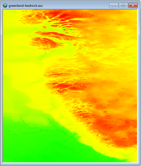
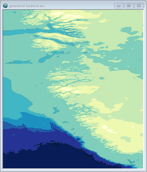
A GIS (map) file, when open, looks as follows:
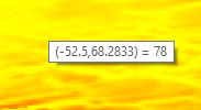
Hovering the mouse over the map shows the coordinates of the cell and the value corresponding to that cell. Please note that the text format (.asc) stores just one numerical value for each of the raster cells.
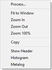
The Geo Menu allows for displaying the header of the map file and also a histogram of the values that the map contains
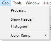
These choices are also available through the map context menu
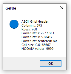
Show header summarizes the map parameters, notably its size (in terms of the number of columns and rows in the raster file), cell size, map origin in terms of Earth coordinates of its lower-left corner, and value that denotes missing values.
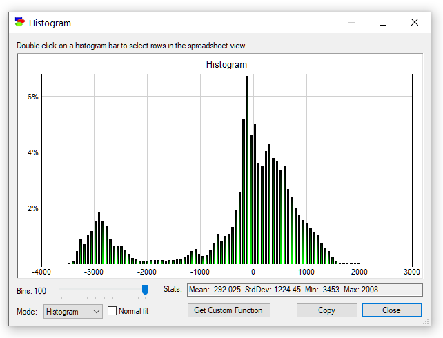
Histogram gives an idea of the occurrence of different values in the map.
Metalog opens the Fitting Metalog distribution to data dialog that allows for fitting a metalog distribution to the values present in the map (in other words, fitting a metalog distribution to the histogram shown by the Histogram command applied to the map).
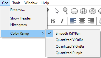
While GeNIe does not attempt to replicate the capabilities of GIS software, it is possible to modify the color ramp of the map file. Top that effect, please choose one of the ramps listed in the Geo Menu.
The greenland-bedrock.asc map viewed in the Quantized YIGnBu color ramp, looks as follows:
We will show how to process maps in the next section.